June 12 , 1793 (Day 35)
Excerpts from the Journal of Alexander MacKenzie on his epic Voyage of Discovery to the Pacific Ocean.
“The weather was the same as yesterday, and we proceeded between three and four in the morning. We took up the net which we had set the preceding evening, when it contained a trout, one white fish, one carp, and three jub.”
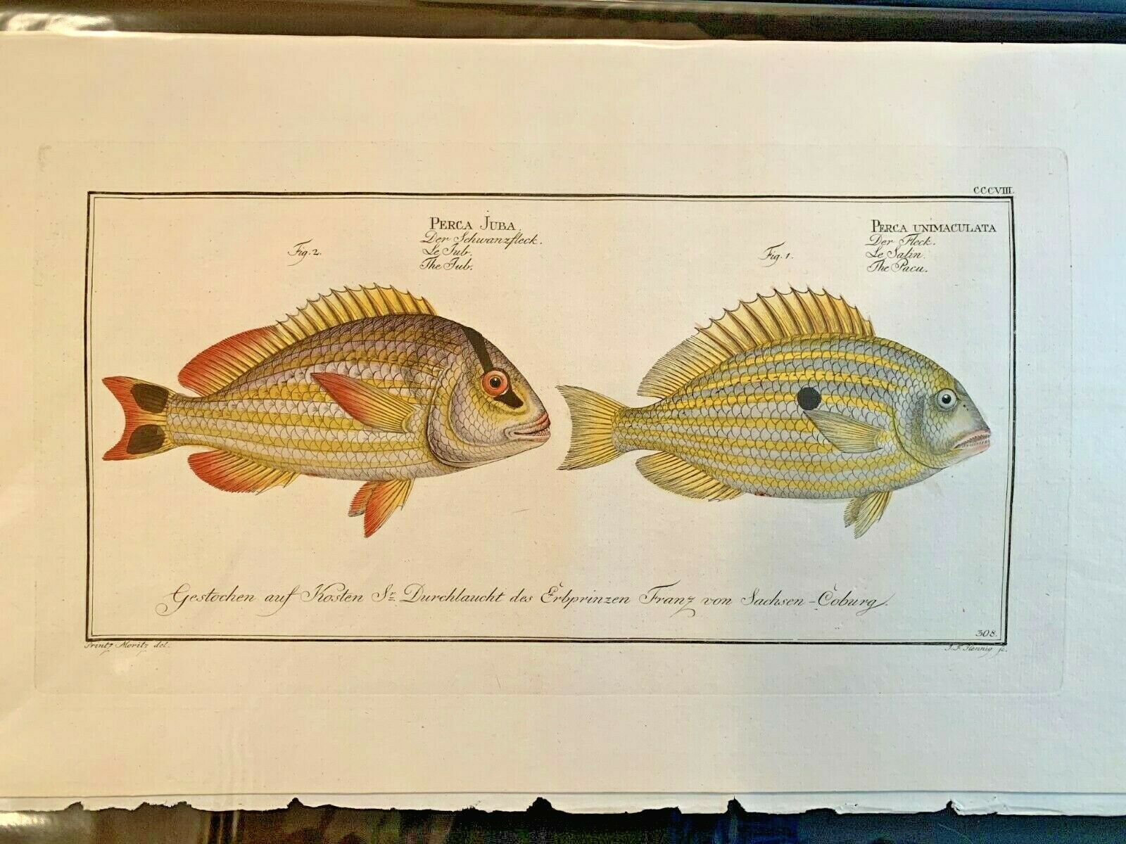
Picture 1. Showing a “Jub” fish.
“The lake is about two miles in length, East by South, and from three to five hundred yards wide. This I consider as the highest and Southernmost source of the Unjigah, or Peace River…”
Arctic Lake.
This area containing the old indigenous route is now protected and is known as the Arctic Pacific Lakes Provincial Park. The main feature of the 13,887 hectare park is three small lakes that straddle the Continental Divide in a narrow, steep-sided glacial overflow channel. “The lake” he refers to here is Arctic Lake, and is located in the headwaters of the Parsnip River drainage that eventually drains into the Arctic Ocean. These lakes and streams support diverse fish populations, and today, as then, provide excellent opportunities for sport fishing. Diverse fish populations including lake trout, bull trout, rainbow trout, kokanee, dolly varden, mountain whitefish, redside shiner, lake char, and chinook salmon, and arctic grayling in Arctic Lake. In just a few years time the river MacKenzie has just traced to its source will become known as the Parsnip River, and as a tributary of the Peace.

Picture 2. Arctic Pacific Lakes Provincial Park. (BC Parks photo)
“We landed and unloaded, where we found a beaten path leading over a low ridge of land eight hundred and seventeen paces in length, to another small lake...this being the highest point of land dividing these waters, and we are now going with the stream.”
In those 817 paces, Alexander MacKenzie has just crossed the Continental Divide. The waters of the now aptly named Portage Lake, and all the water ahead of him will drain into the Pacific. Most importantly, they are now “going with the stream”, and no longer have to work at paddling and poling against the current.
“At five we entered a small round lake of about one third of a mile in diameter.”
Little Lake.
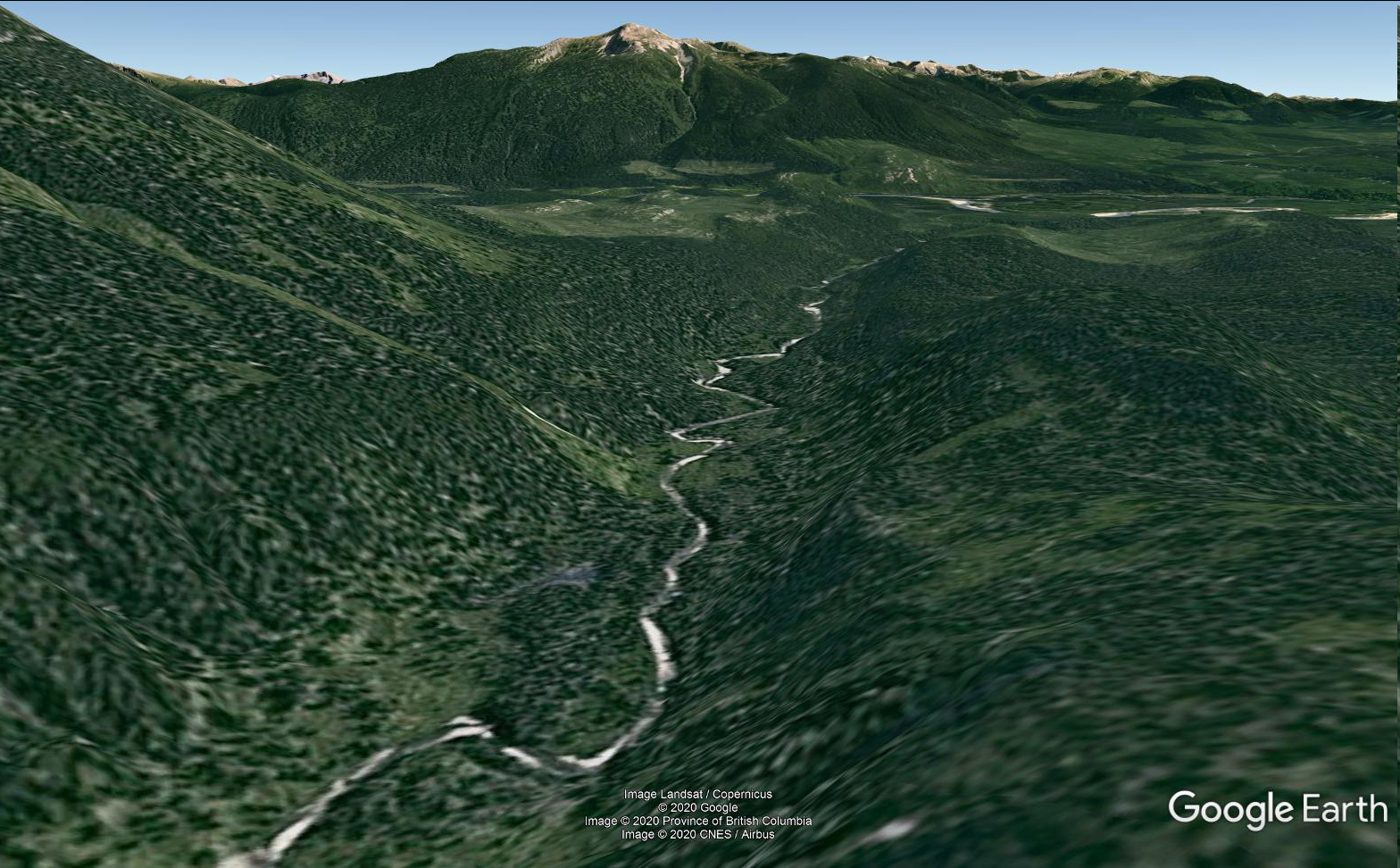
“At half past six we were stopped by two large trees that lay across the river...Here we unloaded and formed our encampment.” The campsite of this day is one hour and half (by birchbark canoe) SE of Little Lake. “At this place our guide manifested evident symptoms of discontent...expressed an anxiety to return. He shewed us a mountain, at no great distance, which he represented as being on the other side of a river, into which this empties itself.” Picture 3.
This Google earth Image is taken from just above the site of June 12 camp, looking SE. The “Mountain on the other side” is at centre top of this image.
No comments:
Post a Comment