Excerpts from the Journals of Alexander MacKenzie; on his epic Voyage to the Pacific in 1793 via the Peace River.
“At break of day we entered on the extraordinary journey which was to occupy the remaining part of it. The men began, without delay, to cut a road up the mountain...The baggage was now brought from the water side to our encampment. This was...a very perilous undertaking...as one false step...would have been instantly followed by falling headlong into the water.”
They are beginning the long portage. For reasons that are unclear, he missed the “Indian carrying-place”, the portage trail starting near present day Hudson’s Hope, that had been used by First Nations for centuries. Some history suggests that he was too frightened by the chance of running into violent natives; others suggest that he simply couldn’t or didn’t find it, or maybe that he just wanted to try the river to find out for himself. I think this is more likely, as even after they start to make their own makeshift trail, he still sends men looking for the “Indian carrying-place”. Either way, he was forced to abandon the river in the midst of the canyon, and his crew must now drag the canoe and everything in it up the steep banks, around obstacles, over the mountain and eventually to the upper river.

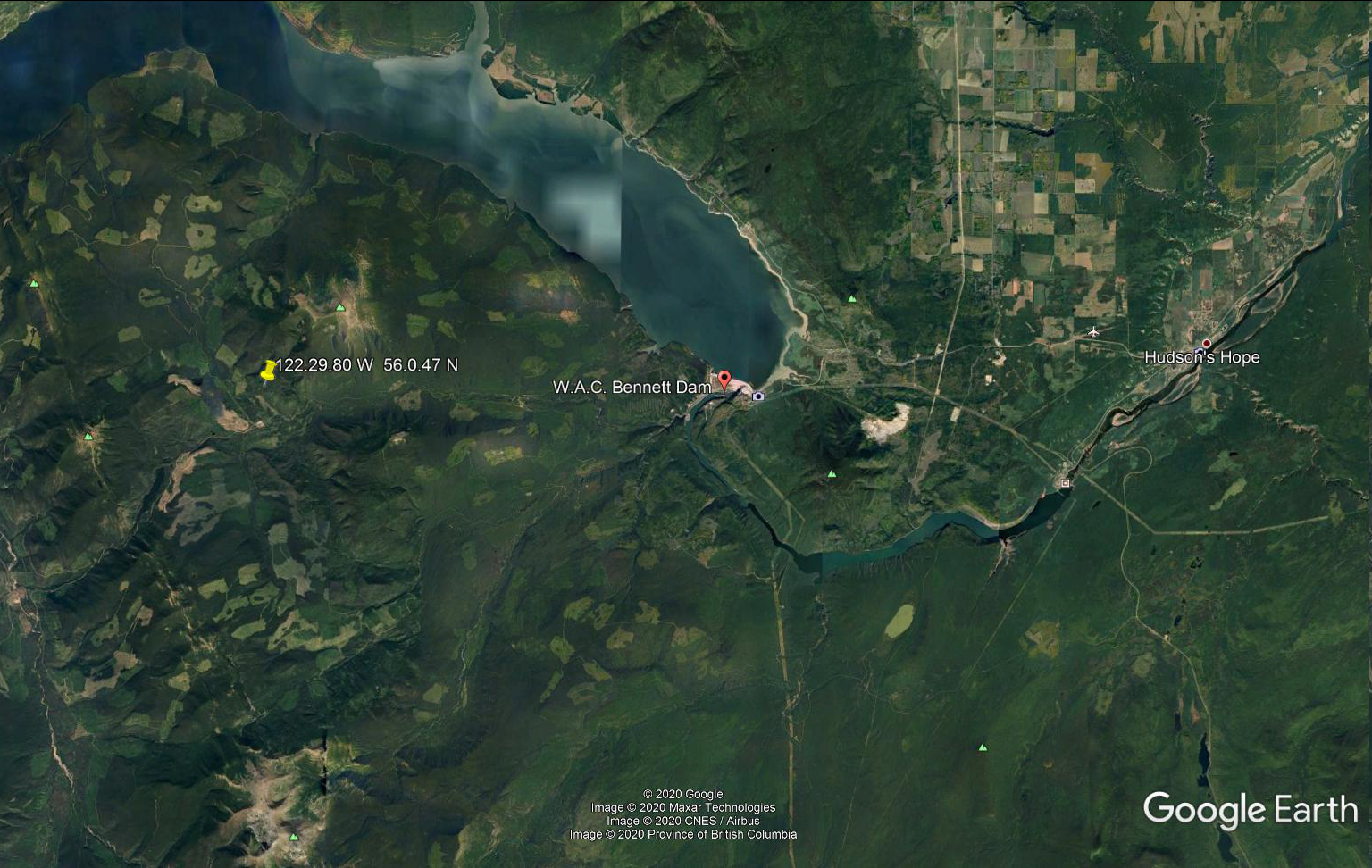
“Indeed by a general and most laborious exertion, we got everything to the summit by two in the afternoon. At noon, the latitude was 56.0.47 North. At five I sent the men to cut the road onwards…”
“At about ten, I observed an emersion of Jupiter’s second satellite; time by the achrometer 8.32.20. By which I found the longitude to be 120.29.80 West from Greenwich.”
This reckoning is out, by about 2 degrees. If he had found it to be 122.29.80, then he would be very close to correct. I don’t know if he has actually made this large of an error in calculation, or if it is a misprint somewhere between his journal written on the river and the later published work. Either way, he is much farther west than the 120 meridian, (the BC-Alberta border), which he had passed on the 14th. When he took the reckonings of longitude at Fort Fork the previous season, we found that the Fort was actually 8 miles East from his finding. So, if you Google Earth his (revised) numbers; 122.29.80 W and 56.0.47 N, and then go East 8 miles; that should be very close to where he was on this day, 227 years ago.
No comments:
Post a Comment